
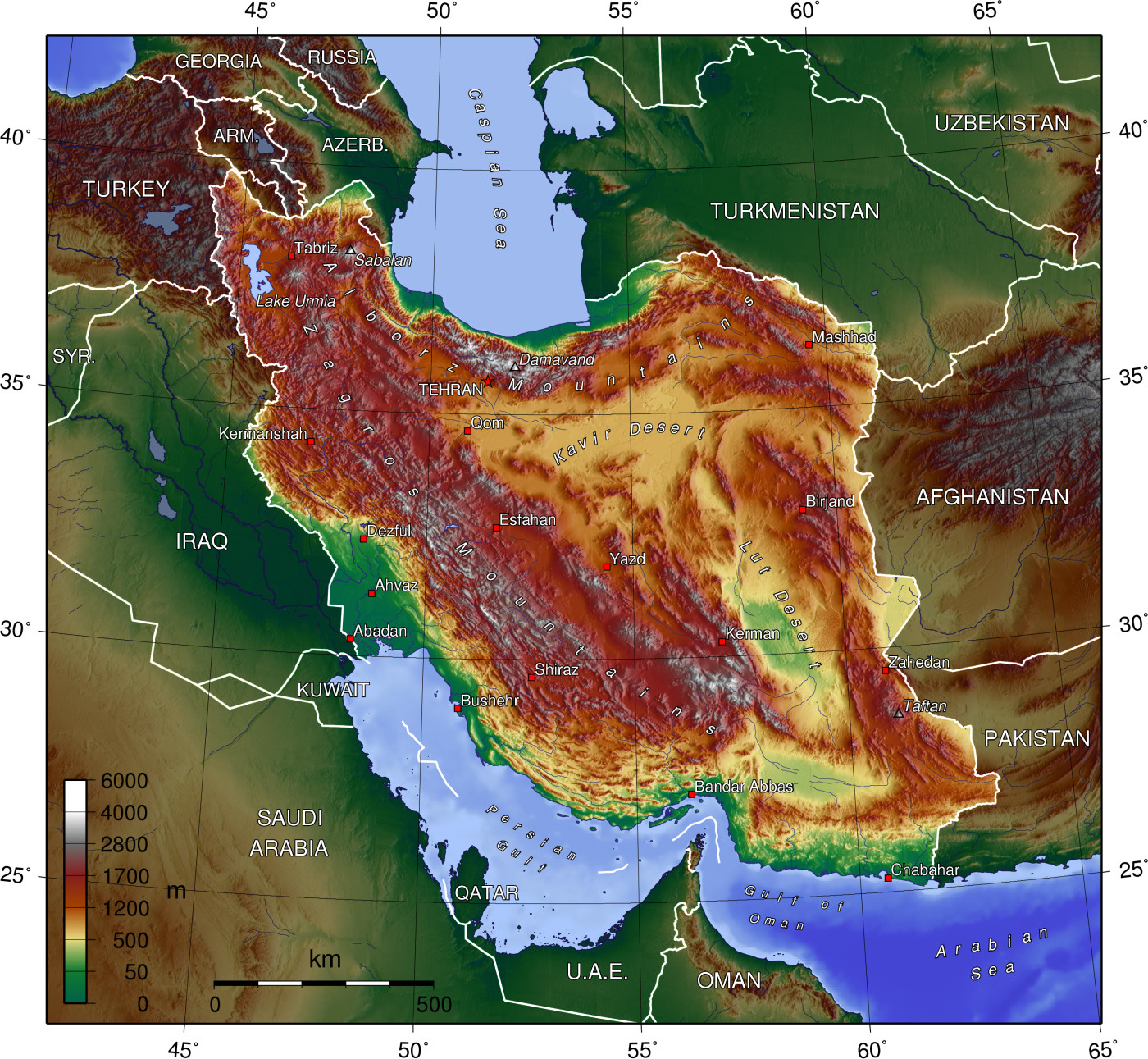
Geography of Iran
Iran shares its northern borders with several past Soviet states: Armenia, Azerbaijan, and Turkmenistan. These borders extend for more than 2,000 km, including nearly 650 km of water along the southern shore of the Caspian Sea. Iran’s western borders are with Turkey in the north and Iraq in the south. The Persian Gulf and Gulf of Oman littorals form the entire 1,770 km southern border. To the east lie Afghanistan on the north and Pakistan on the south.
Topography
The topography of Iran consists of rugged, mountainous rims surrounding high interior basins. The main mountain chain is the Zagros Mountains, a series of parallel ridges interspersed with plains that bisect the country from northwest to southeast. Many peaks in the Zagros exceed 3,000 meters above sea level, and in the south-central region of the country there are at least five peaks that are over 4,000 meters. As the Zagros continue into southeastern Iran, the average elevation of the peaks declines dramatically to under 1,500 meters. Rimming the Caspian Sea littoral is another chain of mountains, the narrow but high Alborz Mountains. Damavand volcanic mountain with a height of 5610 meters, located in the center of Alborz, is not only the highest peak in the country, but also the highest mountain in Eurasia west of the Hindu Kush and the highest volcano in Asia.
List of highest mountains in Iran(four-thousanders)

The center of Iran consists of several closed basins that collectively are referred to as the Central Plateau. The average elevation of this plateau is about 900 meters, but several of the mountains that tower over the plateau exceed 3,000 meters. The eastern part of the plateau is covered by two salt deserts, the Dasht-e Kavir (Great Salt Desert) and the Lut desert. Except for some scattered oases, these deserts are uninhabited.
Iran has only two expanses of lowlands: the Khuzestan Plain in the southwest and the Caspian Sea coastal plain in the north. The former is a roughly triangular-shaped extension of the Mesopotamia plain and averages about 160 km in width. Much of the Khuzestan plain is covered with marshes.
The Caspian plain is both longer and narrower. It extends for some 640 km along the Caspian shore, while at some places less than 2 km separate the shore from the Alborz foothills.
Iran has a variable climate. In the northwest, winters are cold with heavy snowfall and subfreezing temperatures during December and January. Spring and fall are relatively mild, while summers are dry and hot. In the south, winters are mild and the summers are very hot, having average daily temperatures in July exceeding 38 °C. On the Khuzestan Plain, summer heat is accompanied by high humidity.
In most of the country, yearly precipitation averages 250 mm or less. The major exceptions are the higher mountain valleys of the Zagros and the Caspian coastal plain, where precipitation averages at least 500 mm annually. In the western part of the Caspian, rainfall exceeds 1,000 mm annually and is distributed relatively evenly throughout the year.
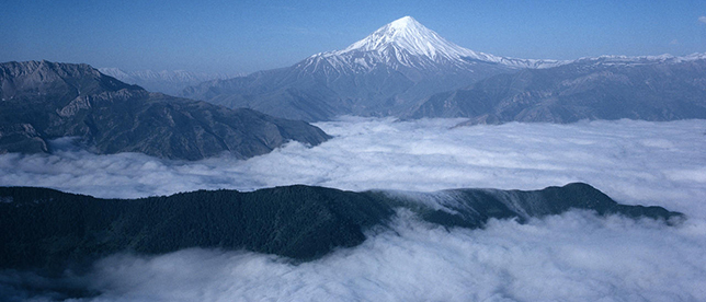
Mount Damavand is the highest volcano in Asia
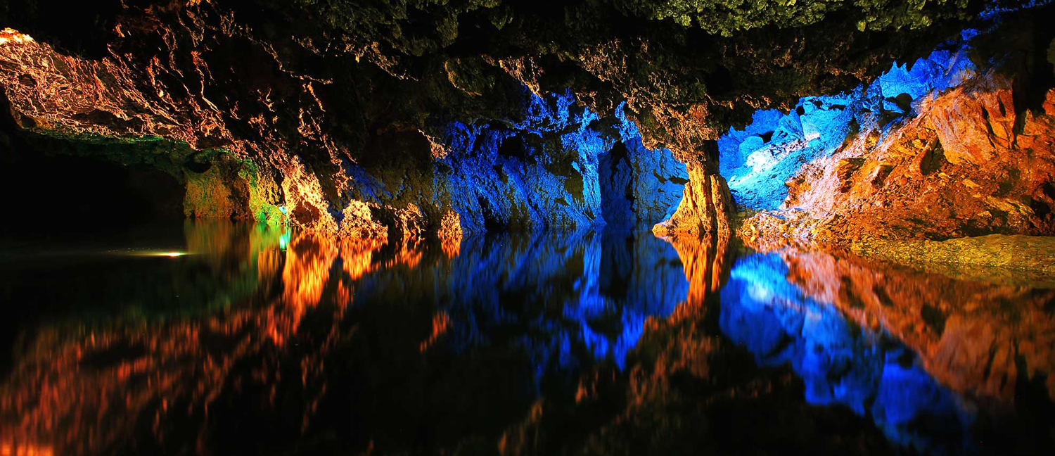
Ali-Sadr Cave (the world‘s largest water cave) in north of Hamedan.
Flora
7% of the country is forested. The most extensive growths are found on the mountain slopes rising from the Caspian Sea, with stands of oak, ash, elm, cypress, and other valuable trees. According to FAO reports, the major types of forests that exist in Iran and their respective areas are:
Caspian forests of the northern districts – 19,000 km.
Limestone mountainous forests in the northeastern districts (Juniper forests) – 13,000 km.
Pistachio forests in the eastern, southern and southeastern districts – 26,000 km.
Oak forests in the central and western districts – 35,000 km.
Shrubs of the desert districts in the central and northeastern part of the country – 10,000 km.
Sub tropical forests of the southern coast, like the Hara forests – 5,000 km.
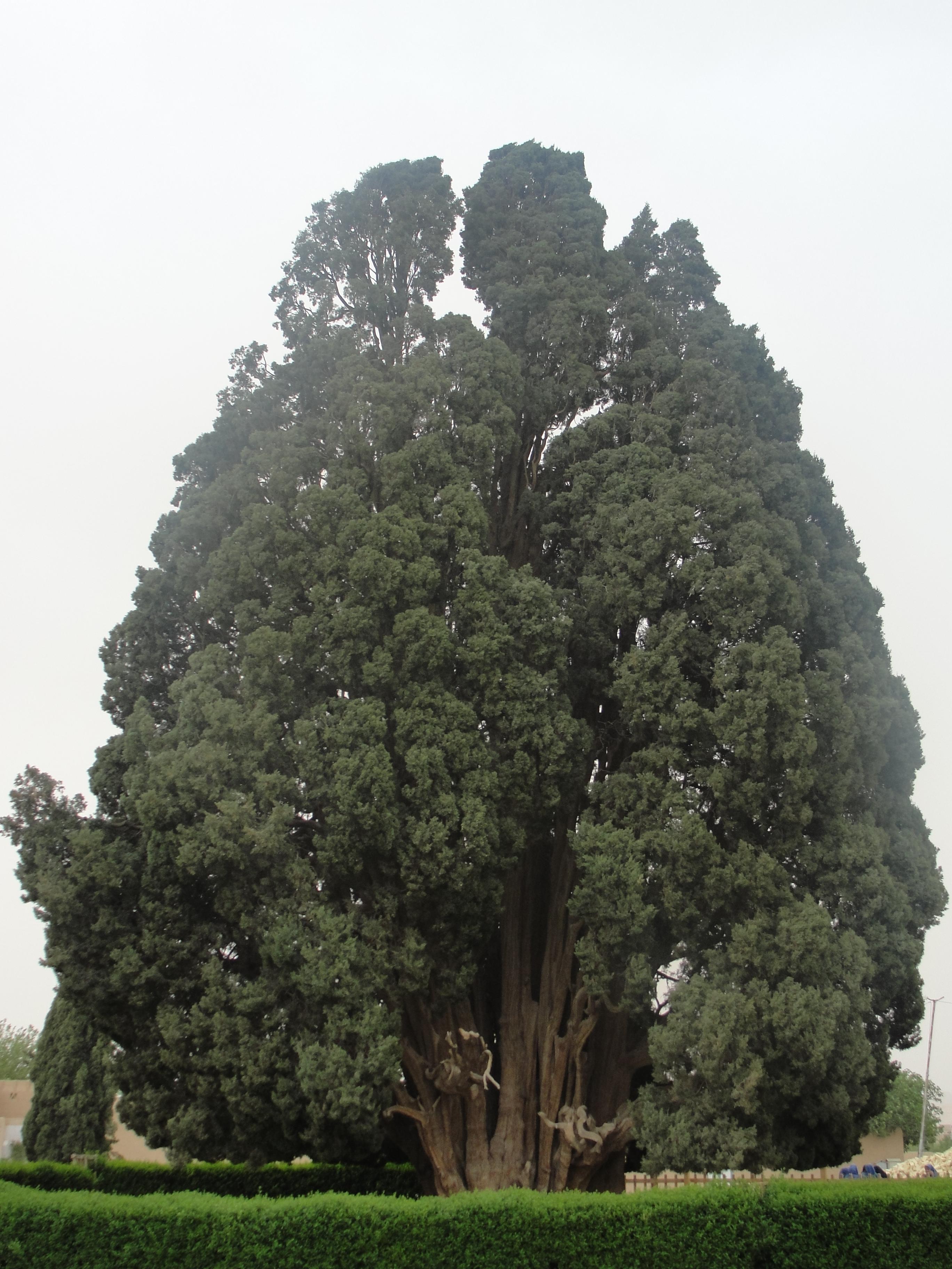
The Cypress of Abarkuh. the oldest or second-oldest living thing in Asia.
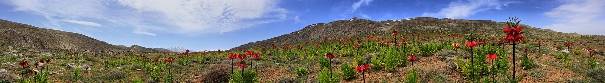
Crown imperial plain in Sepidan, In the southern Zagros mountains
Wildlife
According to the statistics of Iran’s Environmental Protection Organization, 2,000 animal species, including mammals, birds, reptiles, amphibians and fishes of inland waters and about 1,200 species of fishes have been identified in marine waters, in terrestrial ecosystems and inland waters of the country. Among these species, we can mention 210 species of mammals, 640 species of birds, 300 species of reptiles, 23 species of amphibians and 350 species of inland water fish.
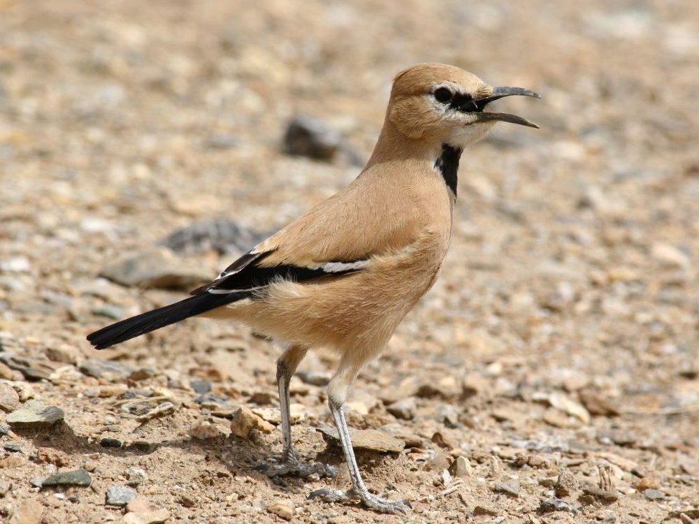
Persian ground jay
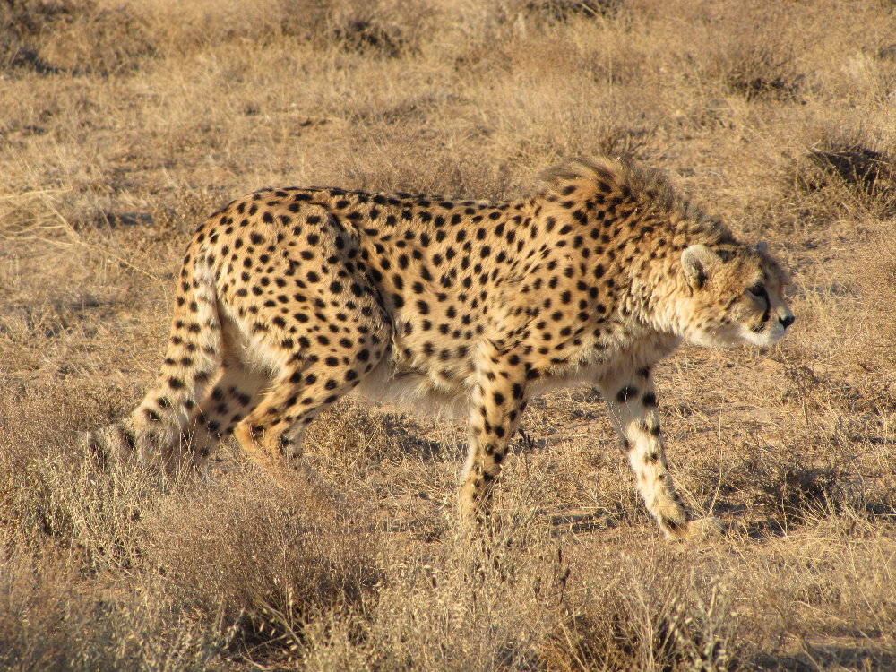
An Asiatic cheetah in Miandasht Wildlife Refuge- North Khorasan
Ecosystem and biosphere
Iran’s bio-diversity ranks 13th in the world. There are 272 conservation areas around Iran for a total of 17 million hectares under the supervision of the Department of Environment, variously named national parks, protected areas, and natural wildlife refuges, all meant to protect the genetic resources of the country.
The national parks, protected areas, and wildlife refuges in Iran include:
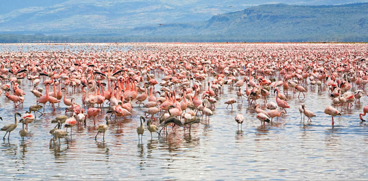
Flamingos in Miankaleh peninsula

Lar National Park
National Parks:
Bakhtegan, Bamu, Bojagh, Dayer-Nakhiloo, Ghamishl, Ghatroyeh, Golestan ,Kavir, Khabr, Khar Turan, Kiasar, Kolahghazi, Lake of Ghosts, Lake Urmia, Lar, Naybandan, Paband, Salouk, Siyahkooh, Sorkheh Hesar, Tandooreh, Tang e Sayad, Sarigol.
Protected Areas:
Arasbaran, Arjan, Bafq, Baloot Boland, Bisotun, Central Alborz, Dehdez, Dena, Dinar Kouh, Haftad Goleh, Hamoon Wetlands, Hara, Haraz, Heleh, Gando, Geno, Ghalajeh, Kabir Kouh, Karkas, Karkheh, Kavir, Koulak, Kuh-e-Dil, Lake of Ghosts, Manesht & Ghelarang, Mianjangal, Miankaleh, Mozaffari, Nazhvan, Oshtoran Mountain, Sheyvand, Shaloo & Mongasht, Shimbar and Lake Area of Karun Dam, Siahkeshim, Siahroud Roudbar, Touran.

Dena Protected Area
Wildlife Refuges:
Amirkalayeh, Bakhtegan, Dar-e Anjir, Hamoon, Miandasht, Miankaleh, Mouteh, Naybandan, Robat Shur, Selkeh, Shadegan, Shidvar, Sorkhankol, Touran.
Natural National Heritage Sites:
Alisadr Cave, Alvand, Badab Surt, Bil spring, Bisheh Waterfall, Chenar e Kamarbasteh, Chenar e Khameneh, Chenar e Sukhteh Sarakhs, Chenar e Sukhteh Shahrud, Deymeh Headwater, Gamasiyab Cave, Gamasiyab Headwater, Parau Cave, Ganjnameh Waterfall, Gerit Waterfall, Giyan Headwater, Golestan National Park, Headwater of Bisotun, Jashak salt dome, Mount Damavand, Karun, Nojian Waterfall, Ovan Lake, Piran waterfall, Quri Qala Cave, Rahmat tree, Sabalan, Cypress of Abarkuh, Cypress of Mehregan, Shaho, Valasht lake, Zayanderud ,Zribar Lake
Top UNESCO
Tours
About
Our Newsletter
Subscribe to our newsletter and get exlusive first minute offers straight into your inbox.
Tours
Top UNESCO
About
Our Newsletter
Subscribe to our newsletter and get exlusive first minute offers straight into your inbox.
