The property of Bam and its Cultural Landscape is located on the southern edge of the Iranian high plateau, in Kerman Province, in south-eastern Iran, close to the Pakistan border. The origins of the citadel of Bam, can be traced back to the Achaemenid period (6th to 4th centuries BC) and even beyond. The heyday of the citadel was from the 7th to 11th centuries, being at the crossroads of important trade routes and known for the production of silk and cotton garments. The citadel, which contains the governor’s quarters and the fortified residential area, forms the central focus of a vast cultural landscape, which is marked by a series of forts and citadels, now in ruins. The existence of life in the oasis was based on the underground irrigation canals, the qanāts, of which Bam has preserved some of the earliest evidence in Iran and which continue to function till the present time. Arg-e Bam is the most representative example of a fortified medieval town built in ver
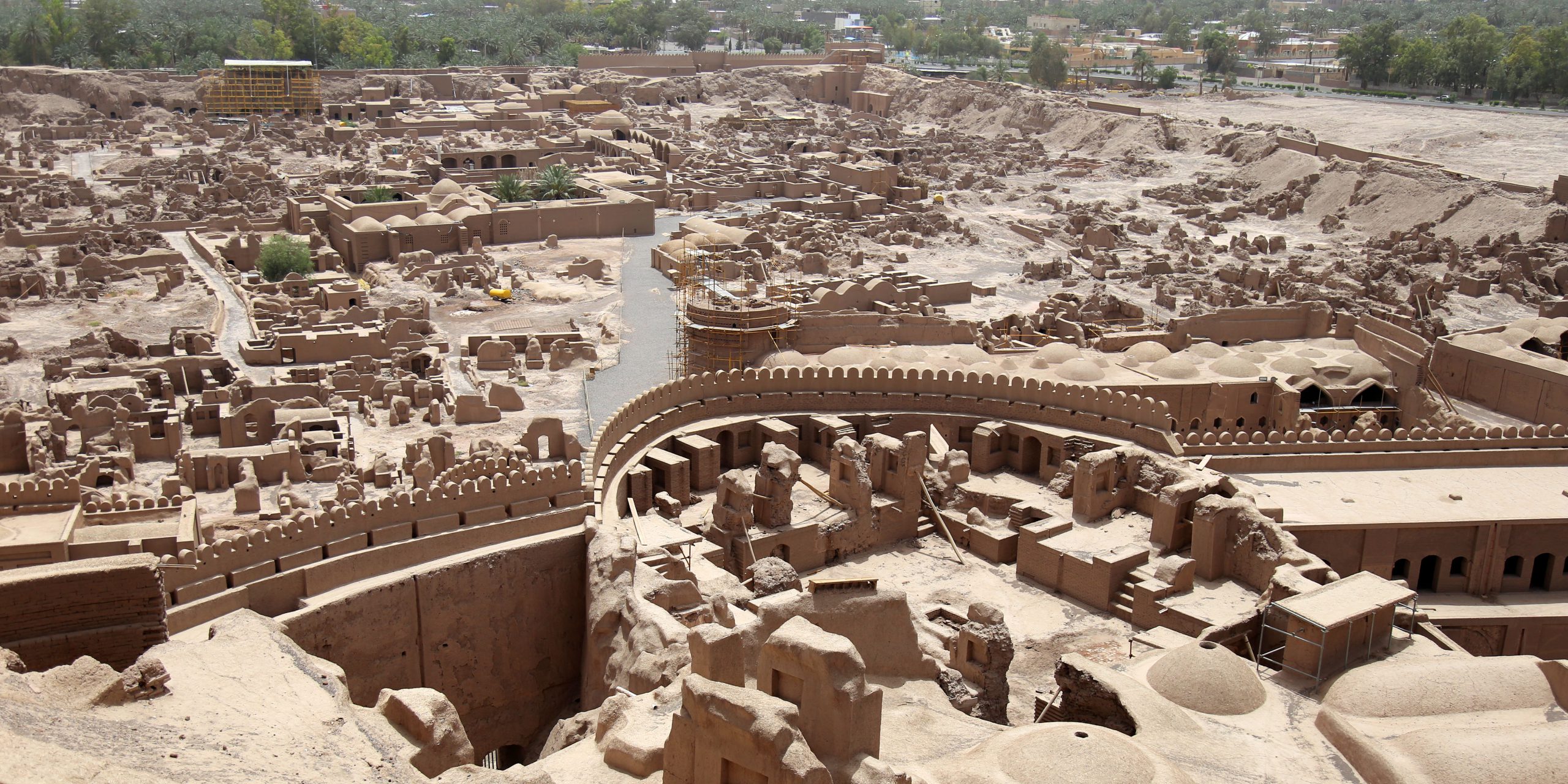
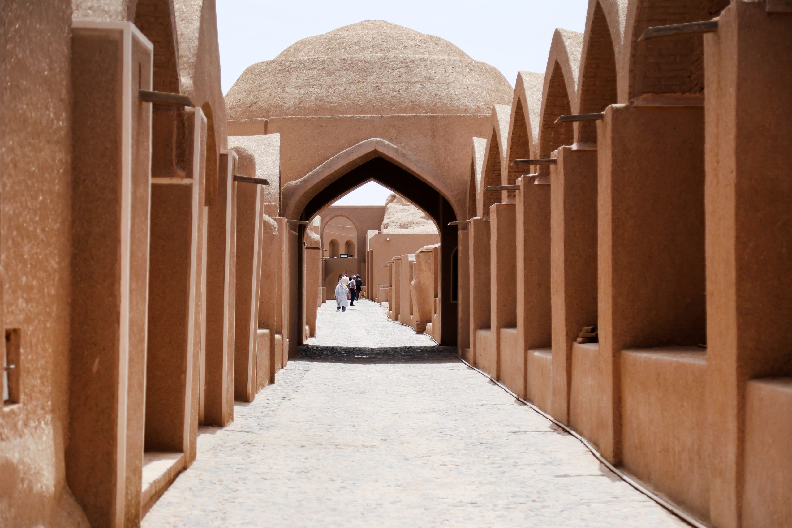
The property of Bam and its Cultural Landscape is located on the southern edge of the Iranian high plateau, in Kerman Province, in south-eastern Iran, close to the Pakistan border. The origins of the citadel of Bam, can be traced back to the Achaemenid period (6th to 4th centuries BC) and even beyond. The heyday of the citadel was from the 7th to 11th centuries, being at the crossroads of important trade routes and known for the production of silk and cotton garments. The citadel, which contains the governor’s quarters and the fortified residential area, forms the central focus of a vast cultural landscape, which is marked by a series of forts and citadels, now in ruins. The existence of life in the oasis was based on the underground irrigation canals, the qanāts, of which Bam has preserved some of the earliest evidence in Iran and which continue to function till the present time. Arg-e Bam is the most representative example of a fortified medieval town built in vernacular technique using mud layers (Chineh), sun-dried mud bricks (khesht), and vaulted and domed structures.
On December 26, 2003, at 5:26 AM, Bam was struck by a large earthquake. The US Geological Survey estimated its magnitude at 6.6 on the Richter scale. This very destructive earthquake left about 26,200 dead, thousands injured and more than 75,000 homeless. The Bam Citadel was severely damaged after the earthquake and placed on the endangered list, but due to the restorations carried out over the past years, In July 2013, UNESCO removed the Bam citadel from the list of endangered works.
nacular technique using mud layers (Chineh), sun-dried mud bricks (khesht), and vaulted and domed structures.
On December 26, 2003, at 5:26 AM, Bam was struck by a large earthquake. The US Geological Survey estimated its magnitude at 6.6 on the Richter scale. This very destructive earthquake left about 26,200 dead, thousands injured and more than 75,000 homeless. The Bam Citadel was severely damaged after the earthquake and placed on the endangered list, but due to the restorations carried out over the past years, In July 2013, UNESCO removed the Bam citadel from the list of endangered works.


